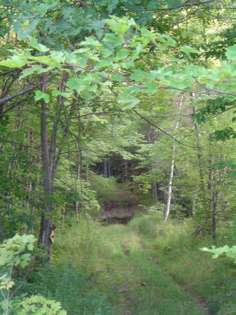
IMAGES FOR DISCONTINUED ROAD
What does a discontinued road look like? Public maintenance ceases when a road is discontinued, leaving the road to deteriorate unless a private individual takes on the expense. Unless otherwise indicated, the pictures below all show Maine roads that have been discontinued or abandoned. Most of them remain "public easements," which means that although they are no longer kept in repair with public funds, legally they remain open to public use by foot or motor vehicle. Whether or not this is actually possible is another question! A few of the roads shown are quite passable, but that doesn't happen by itself; you can be sure that in each of these cases, someone is suffering the cost of public use.
 |
| Road east of Tilton Pond, Fayette. A typical public easement - open to "unfettered" public motor vehicular travel. |
 |
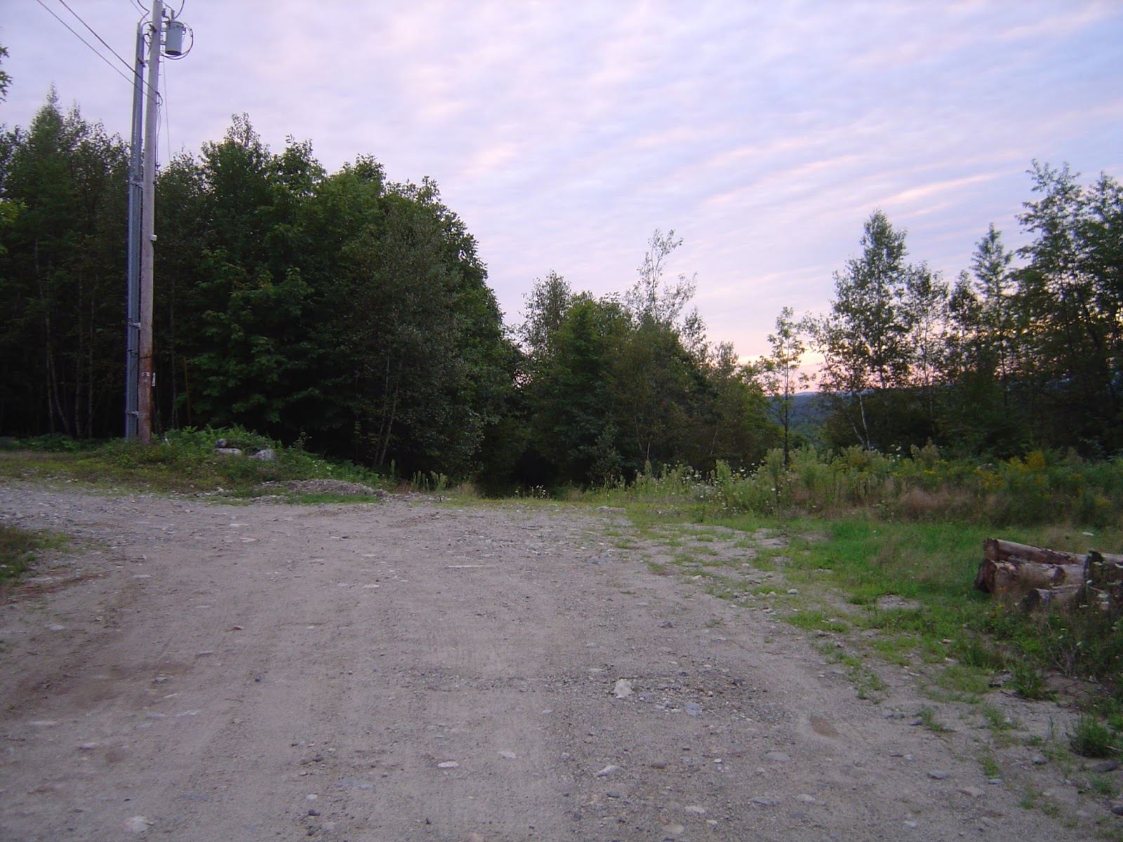
| Folsom Road, Fayette. Another typical public easement, open to "unfettered" public motor vehicular travel. The road is straight ahead. |
 |
| This is actually a private road, but it illustrates what can happen when there are insufficient funds to keep a road in shape. This culvert washed out on a weekend, leaving a family stranded on the other side, and there were insufficient road association funds to repair it. So the family used what they had on hand to build a makeshift bridge, and posted this sign to warn anyone who might attempt to cross it. Other land owners and friends eventually pitched in to help repair the culvert, so the bridge is no longer there. |
 |
| STRANDED! They can't get out from their home.... |
 |
| ... and no one else can get in. |
 |
| On a weekend, and with no funds, you use what you've got on hand. Call it Yankee ingenuity. |
 |
| The finished bridge |
 |
| A bit scary looking, but it even held up the delivery of a load of hay! |
 |
| Another public easement after use by a logging operation. Young Rd, Fayette, 1985 |
 |
| This road had been passable by 2 wheel drive the previous fall. |
 |
| Same public easement |
 |
| Another view |
 |
| Heading out from the Young Road house for supplies after the logging operation was done required a comealong and several lengths of chain. |
 |
| Crank the comealong all the way in, then run the comealong back out, shorten up the chain, and do it again. In some places there weren't many trees left to use as anchor points. |
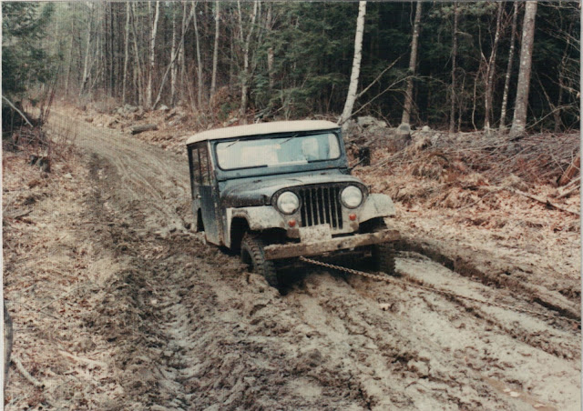 |
| The process had to be repeated in several places along the half mile of road. |
 |
Dragging bottom.
 |
Sometimes it took over an hour to go the half mile to the paved road, then the process had to be repeated on the way home.
|
|
 |
| Up on "solid" ground at last! |
 |
The Dearborns in Mount Vernon stand in front of the gate to their driveway. Originally they had built it over the road on the left, Bog Road, under the understanding that the road had been discontinued before 1965 and was therefore their private property. But then the Town informed them that the records had been lost so they had later declared the road to be abandoned under section 3028, making it a public easement. When another land owner took advantage of the maintenance the Dearborns had put into the road, and started using it with his heavy equipment, they were forced to move their driveway over in order to avoid having to maintain the road for his (and the general public's) use.
 |
Bog Road, Mount Vernon, beyond the Dearborns' property. Yes, the road goes straight ahead.
|
|
 |
| Same spot as above, after the neighbor opened it up as an ATV trail, telling the ATV club he had permission of all the landowners (which was not true.) The DEP quickly shut it down again. |
 |
This bog is immediately to the left of the photo above, where the sun is shining through the trees.
 |
| Remains of old stone dam on the former Highway F in Farmington. The State didn't know they had discontinued the old road without easement before the 1965 change in the discontinuance law, so they thought they still owned this structure. They planned to tear it down and use the stone in rebuilding a culvert, so they came in and cut down all the trees around it without permission of the landowner. This is one more example of why we need better record keeping when roads are discontinued or abandoned. |
THE ROADS BELOW ARE ALL PUBLIC EASEMENTS IN THE TOWN OF FAYETTE UNLESS OTHERWISE NOTED |
 |
Tilton Pond Road looking South
 |
| Tilton Pond Road looking South |
 |
| South end of North Road, looking South from where it crosses Jackman's Mill Rd |
|
 |
| William Livermore Rd |
 |
| Oscar Young Rd |
 |
| Philip Davis Rd - yes, the road continues straight ahead. |
 |
| Asa Hutchinson Rd looking southeast |
 |
| Folsom Rd looking northwest - road is straight ahead |
 |
| Folsom Rd closer view of No Trespassing sign |
 |
| Fayette Ridge Road straight ahead |
 |
| Limberlost Road |
 |
| Folsom Rd from Twelve Corners end (it goes straight ahead here, not to the right) |
 |
| Knox Hill Rd continues straight ahead |
 |
| Myra Brown's driveway road continues straight ahead |
 |
| Myra Brown's Driveway Rd "obstructed" by car. |
 |
Myra Brown's Driveway Rd from Baldwin Hill Rd (road is straight ahead) - obstructed by gate and by pasture fence on far side of field.
|
 |
| Asa Hutchinson Rd looking northwest from Baldwin Hill end |
 |
| Bamford Pond Rd from Cemetery |
 |
| Bamford Pond Rd from cemetery (closer view) |
 |
Oak Hill Rd looking southeast from cemetery at Sanderson's Corner Road
|
 |
| Oak Hill Rd from house beyond cemetery |
 |
| Oak Hill Rd from Gile Rd looking west |
 |
Oak Hill Rd looking east at Gile Rd, which just shows above the ledge
 |
Oak Hill Rd from Gile Rd looking towards Young Rd
|
|
 |
Norton Road from Oak Hill Road looking north
 |
| Norton Rd from Oak Hill Rd looking north |
|
 |
| Oak Hill Road from junction with Norton Road, looking northwest |
 |
| Oak Hill Road straight ahead, Young Road to left. |
 |
| Oak Hill Road looking northwest from junction with Young Road |
 |
| Oak Hill Road straight ahead, looking northwest from near Young Road, just beyond house. |
 |
| Oak Hill Road looking northwest from near junction with Young Road, beyond house. |
 |
| Young Road looking south from junction with Oak Hill Road |
 |
| Young Road from top of hill, looking south |
 |
| Young Road looking down south side of hill. |
 |
| Young Road looking down north side of hill |
 |
| Surrey Road from north end looking south |
 |
| Surrey Rd looking south |
 |
| Lower end of Ed Rose Rd (now called Sullivan's End) |
 |
| Lower end of Ed Rose Road (now known as Sullivan's End) - road goes straight ahead, not to left. |
 |
| Lower end of Ed Rose Rd beyond house |
 |
Young Road from Richmond Mill Road
|
 |
| South end of Young Road looking north from beyond last house. |
 |
| Mid section of Young Road looking north |
 |
| Mid section of Young Road looking north |
 |
| Mid section of Young Road, looking north |
 |
| Middle of Surrey Road, looking north |
 |
| Surrey Road looking northerly from beaver swamp |
 |
| Surrey Road looking southerly near Fayette-Wayne line |
 |
| Ed Rose Road, Wayne, looking southeast towards Surrey road from near Fayette line, showing erosion in ruts left by a hunter the previous fall. |
 |
Ed Rose Road, Wayne, looking back up the rut in the picture above from a bit farther down. This damage was caused by one pass with one vehicle.
|
 |
Ed Rose Road, Wayne, looking towards Fayette
|
 |
Continuing down Ed Rose Road towards Fayette
|
 |
| Continuing down Ed Rose Road towards Fayette |
 |
Troubled Bridge over water? Ed Rose Road looking towards Fayette from Wayne.
|
 |
| Ed Rose Road looking back across bridge into Wayne from near Fayette line. |
 |
| Surrey Road, Fayette, looking northerly after someone drove through in mud season, on or about April 17, 2016. This and the next 14 pictures all taken April 19. |
 |
| Surrey Road, Fayette |
 |
| Surrey Road, Fayette |
 |
| Surrey Road, Fayette, looking southerly |
 |
| Anyone recognize this tire tread? |
 |
| Ruts in Surrey Road, Fayette |
 |
| Surrey Road, Fayette, looking Southerly |
 |
| Surrey Road, Fayette, looking northerly |
 |
| Surrey Road, Fayette, looking southerly |
 |
| Surrey Road, Fayette, looking southerly |
 |
| Surrey Road, Fayette, looking southerly. Note drag marks from differential. |
 |
| Surrey Road, Fayette |
 |
| Surrey Road, Fayette, approaching Wayne line |
 |
| Surrey Road, Fayette, looking northerly. Notice how water runs into road and can't run off the other side. |
 |
| Surrey Road, Fayette, near Wayne line |
(c) Roberta Manter 2016


No comments:
Post a Comment